|
Features
WinGPS Marine is the navigational app which makes it possible to create a full navigational system on your Android device. Below you will find a list of all functions for the app.
Follow your GPS position
When turning on the 'follow mode', your position will be placed in the center of the screen and the chart will automatically shift below the position. You can choose from several following modes; 'North up', 'Course up' and 'Compass mode'.
Note: In WinGPS Marine Lite you will only have the 'North up' mode.
Available for:
 WinGPS Marine WinGPS Marine
 WinGPS Marine Plus WinGPS Marine Plus

Hybrid charts
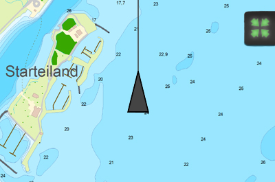
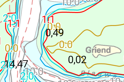
In this app you can use digital nautical charts for navigation. Also Stentec's hybrid charts which include vector data like depth states, buoys, campsites, etc. can also be used in the app.
Available for:
 WinGPS Marine Lite WinGPS Marine Lite
WinGPS Marine
WinGPS Marine Plus
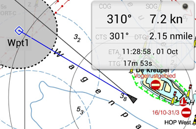
Waypoint navigation
With CTS (course to steer) and DTG (distance to go) you can use this app to navigate to a waypoint. You can create, delete and edit your own waypoints, or use the waypoints that are on the chart database.
Available for:
WinGPS Marine Lite
WinGPS Marine
WinGPS Marine Plus
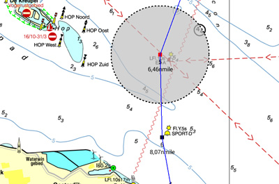
Route navigation
With this app you can create routes and edit them while on the move. Longpress the screen to create a single waypoint or multiple to create a route. You can create multiple routes, and give each route and routepoint a unique name.
Available for:
WinGPS Marine
WinGPS Marine Plus
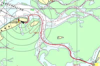
Track management
You can automatically record the sailed tracks. The tracks will be saved to review or share later. You can give each sailed track a unique name.
Available for:
WinGPS Marine
WinGPS Marine Plus
Meteo data
You can download Meteo predictions for a selected area. The wind, air pressure and rainfall can be plotted on the chart view using downloadable GRIB information.
Available for:
WinGPS Marine
WinGPS Marine Plus
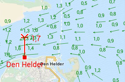
Tidal information
In addition to meteo data you can also download tidal data to use for planning and adjusting your route in this app. You can see the currents, and the depth difference.
Available for:
WinGPS Marine Plus
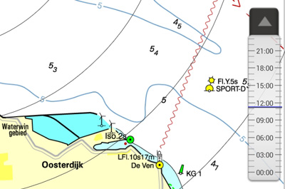
Time bar
By using the time bar you can see the prediction on your track. By sliding it forward you will see the upcoming weather, and tidal information if available.
Available for:
WinGPS Marine
WinGPS Marine Plus
Connect your onboard GPS
Use a Bluetooth or WIFI connection to connect your tablet or smartphone to the GPS receiver of your ship. This makes tracking your location easier, more accurate, and uses less of your battery. If you don't have a wireless GPS on board you can also use the internal GPS of your tablet or smartphone.
Available for:
WinGPS Marine Lite
WinGPS Marine
WinGPS Marine Plus
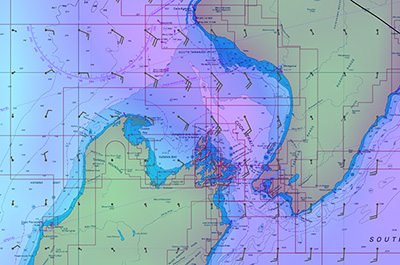
Kustfijn model
Kustfijn Tidal model Rijkswaterstaat with two day wind depended predictions of currents, tides and water levels on the Waddenzee, Ijsselmeer, Markermeer, Randmeren and Zeeland. Red depth lines limit the safe waterways depending on depth, tides and deviations because of the wind.
Available for:
WinGPS Marine Plus
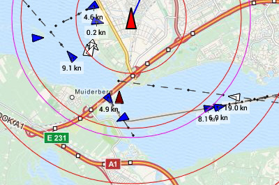
AIS (Automatic Identification System)
Your AIS receiver can communicate with the app using a wireless connection using WIFI or Bluetooth. With AIS you see all surrounding ships plotted on the chart view. You can also bring up the targets in a list, and if you tap a ship's name you can see all the AIS target data. The built-in AIS collision alarm helps you in making important decisions.
Available for:
WinGPS Marine
WinGPS Marine Plus
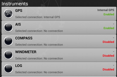
Connect your onboard instruments
Using a wireless connection you can connect your board system and read out your wind meter, compass, log and echosounder. Review all entered and incoming data in the data plotter and instrument monitor to optimize your route for a safe voyage.
Available for:
WinGPS Marine Plus
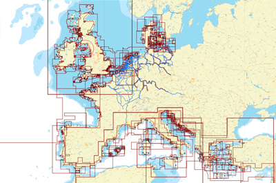
DKW charts
All of Stentec's DKW nautical charts of 2014 and newer are available for use in WinGPS Marine. The DKW charts can be installed with one license code on multiple systems, using your Stentec account. For example on your laptop, tablet and smartphone. The app automatically checks if there are updates available for your installed charts.
WinGPS Marine uses ESRI charts if no DKW charts are installed on your device. This is a free chart overlay system that needs an internet connection. ESRI is not recommended for navigational purposes, but can be used for simple route planning.
WinGPS Marine Lite
WinGPS Marine
WinGPS Marine Plus
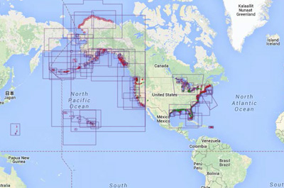
NOAA Tiles
Go to 'chart manager' in WinGPS Marine and turn on the NOAA tiles. If you have a working internet connection, the charts will automatically be shown on your chart screen, covering the American coastal waters.
Available for:
WinGPS Marine
WinGPS Marine Plus
NOAA charts (Offline)
You can download NOAA charts for free from the NOAA website, and install these charts using our Windows software: DKW manager. After installing them manually on your Windows computer, you can transfer these to your tablet for use with WinGPS Marine. Copy the files to: DKW2/USER/.
Available for:
WinGPS Marine Lite
WinGPS Marine
WinGPS Marine Plus
|